DataViz – US Census Data (10/18/2010)

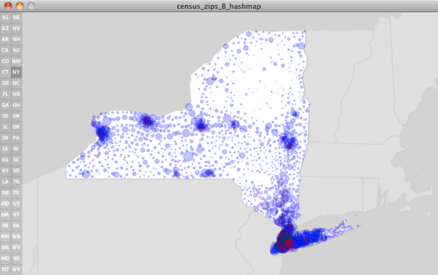
NY State Census Data
This week I tackled a much larger, and much more complex data set: the US Census data on population size, ethnicity, and family income. Much of my time has been in strategizing a data structure and getting my data into these hashmaps, arraylists, and objects. Next I worked on setting up vector maps of each state for the backdrop of the data, as well as programming a user-interface that allows users to pan and zoom the map, while also isolating data for each state.
The sketch in its current form is still very much a work in progress. My next steps are to store position and zoom details for each state to allow users to focus on individual locations, as well as to devise a way to visualize a region’s distribution of wealth as a series of concentric circles. Additionally, I’d like their to be pop-up windows that float in to give text-based info on whatever point your mouse is over. Likely this will turn into a midterm project, as tens of hours will be needed to resolve all this coding.
Link to the LIVE PROCESSING SKETCH. (note, the total filesize is 6.6MB, so please be patient as the sketch folder downloads).